Bad Radkersburg - Altstadt
Styria, Austria — 31 km
🇸🇮 Drava · Slovenia — Altitude 223 m
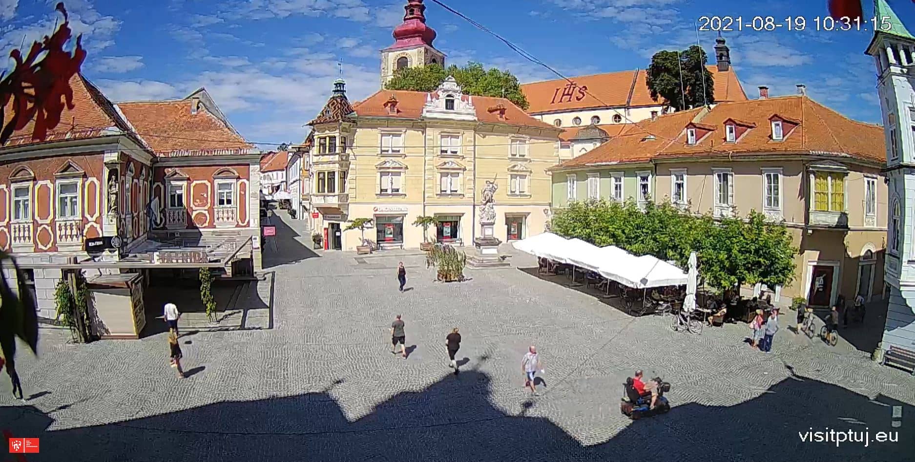
This live camera looks over Ptuj, one of the oldest towns in Slovenia, set on the Drava River in the north-east of the country. Check the stream to see the town as it is right now before you travel, or to get a feel for the river and the weather today.
Ptuj sits on a low hill above the Drava, and its history goes back to Roman times, when it was known as Poetovio. The old town centre is compact, with medieval lanes, churches and a castle on the hill that dominates the skyline. The river valley around it is gentle and green, with vineyards on the slopes nearby, so the town feels both historic and rural at once.
The camera is most useful for judging the mood of the town at different hours: morning light on the rooftops, the calm of the late afternoon and the lit streets after dark. Weather changes the view a lot, so clear days show the surrounding hills best, while mist over the river is common in cooler months. Check the live stream and current conditions before you plan an outdoor walk.
Ptuj has a continental climate with warm summers and cold, sometimes foggy winters, so late spring and early autumn are comfortable for walking. The town is easy to explore on foot. Nearby cameras cover Bad Radkersburg across the border in Austria, which is roughly 31 km away and makes a good day trip alongside Ptuj.
Source: Visit Ptuj
Styria, Austria — 31 km

Styria, Austria — 38 km

Styria, Austria — 38 km
Styria, Austria — 40 km

Styria, Austria — 43 km

Styria, Austria — 49 km
Zagreb, Croatia — 58 km
Styria, Austria — 64 km

Carinthia, Austria — 75 km
Styria, Austria — 77 km
The current conditions and a three-day forecast for Ptuj are shown in the live weather block on this page, so you can check them alongside the camera view.
The local time in Ptuj is shown on this page and updates live. Slovenia uses Central European Time, so the time may differ from where you are.
The camera is in Ptuj in north-eastern Slovenia, on the Drava River at about 223 metres above sea level. The map on this page shows its exact location.
Daylight hours show the town and river most clearly, and late afternoon light is often pleasant. Clear weather gives the best view of the surrounding hills.
Partner links: we may earn a commission at no extra cost to you.