Ramsau bei Berchtesgaden - Hochschwarzeck
Bavaria, Germany — 1.1 km
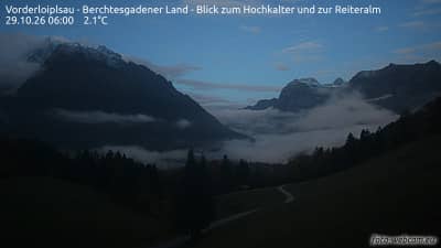
Vorderloiplsau - Berchtesgadener Land - vue sur le Hochkalter et sur la Reiteralm
🇩🇪 Bavaria · Germany — Altitude 1054 m
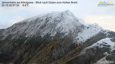
This camera looks out over the Berchtesgaden Alps from the small hamlet of Vorderloiplsau, toward the Hochkalter and the Reiteralm. It is a good place to check whether the peaks are clear before planning a hike or a drive into the valleys. The live player is embedded from the source, and the weather and time blocks below update with the page.
Vorderloiplsau sits in the Berchtesgadener Land, the southeastern corner of Bavaria on the border with Austria. The area is known for steep limestone ranges, deep valleys and the Königssee and Berchtesgaden National Park. The Hochkalter is one of the more recognizable peaks in the region, and the Reiteralm forms a long ridge to the north. The landscape feels remote and alpine even though the larger town of Berchtesgaden is only a short drive away.
The camera is aimed at mountain terrain rather than a town square, so the picture changes mostly with light and weather. Clear mornings often give the sharpest outlines on the ridges, while afternoon cloud can build quickly over the peaks in summer. Snow may cover the higher slopes from late autumn into spring. Watching around sunrise or sunset is worthwhile when the light falls across the rock faces, but the exact view depends on conditions at the time.
The valleys around Berchtesgaden have a cool alpine climate with wet summers and snowy winters. Late June through September is the most reliable period for hiking, while winter suits skiing and snowshoeing. Nearby cameras cover Ramsau bei Berchtesgaden at Hochschwarzeck, the Götschen valley station in Bischofswiesen and the Lockstein view in Berchtesgaden, which help you compare conditions across the area.
Source: foto-webcam.eu
Bavaria, Germany — 1.1 km
Bavaria, Germany — 3.6 km
Bavaria, Germany — 6.8 km
Bavaria, Germany — 7.1 km
Bavaria, Germany — 8 km
Bavaria, Germany — 8.8 km
Bavaria, Germany — 9 km
Bavaria, Germany — 9.3 km
Bavaria, Germany — 9.6 km
Bavaria, Germany — 9.7 km
The current conditions and three-day forecast for Vorderloiplsau are shown in the weather block on this page. Mountain weather can change quickly, so check it before setting out.
The local time for Vorderloiplsau is displayed on this page and follows the Central European time used in Germany.
The camera is in the Vorderloiplsau area of the Berchtesgadener Land in Bavaria, at an altitude of about 1054 metres. The map on this page shows its position.
Early morning and late afternoon usually give the clearest light on the peaks. Clear days in summer and autumn tend to offer the most detailed view.
Partner links: we may earn a commission at no extra cost to you.