
Arosa - Weisshorn
Graubünden, Switzerland — 1.1 km

Arosa - Brüggerhorn
🇨🇭 Graubünden · Switzerland — Altitude 2435 m
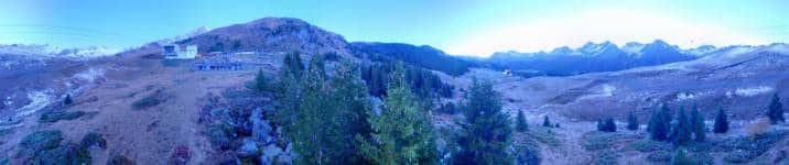
This live camera looks out from the Brüggerhorn area above Arosa, a resort village in the Swiss canton of Graubünden at roughly 2,435 metres. It suits anyone planning a mountain trip or wanting to judge conditions on the slopes before leaving home. The stream is embedded in HD from its owner, with the local time and weather shown beside it.
Arosa sits in a high valley in the eastern Alps, reached by a winding road and a rail line from Chur. The village is known for its mix of traditional Swiss architecture, forested slopes and a lake that sits close to the town centre. In summer the surrounding peaks are used for hiking and mountain biking, while in winter the area becomes a well-known ski destination with a large network of lifts and marked runs. The landscape changes quickly with altitude, from pine woods in the valley to open alpine terrain above the tree line.
Because the view is mountain-focused, the most useful things to check are cloud cover, snow lying on the slopes and how clear the peaks look. Early morning often brings calm air and sharp light on the summits, while afternoons can bring cloud build-up over the higher ground. Seasonal change is the main reason to return: fresh snow in autumn and winter, and green meadows with snowmelt patches in late spring. Conditions can shift within an hour, so the live feed is more reliable than a forecast alone.
Arosa is best visited for skiing from December to March and for hiking from June to September, when trails are open and temperatures are mild in the valley. Summer days can still be cool at altitude, so layers are worth packing even in July. Several other Arosa cameras are listed nearby on this page, including the Weisshorn, Bärenland and Tschuggen views, which help you compare different parts of the resort before you travel.
Source: roundshot.com
Graubünden, Switzerland — 1.1 km
Graubünden, Switzerland — 1.5 km

Graubünden, Switzerland — 1.7 km

Graubünden, Switzerland — 2.5 km

Graubünden, Switzerland — 2.9 km

Graubünden, Switzerland — 5 km

Graubünden, Switzerland — 6.1 km

Graubünden, Switzerland — 7 km

Graubünden, Switzerland — 7.7 km

Graubünden, Switzerland — 9.3 km
The current conditions and a three-day forecast for Arosa are shown in the weather block on this page. Because the village is at high altitude, it can differ noticeably from the weather in lower parts of Graubünden.
The local time for Arosa is displayed on this page and follows Swiss time. Switzerland uses Central European Time, with summer time in the warmer months.
The camera is placed in the Brüggerhorn area above Arosa at about 2,435 metres. The map on this page marks its position so you can see how it relates to the village and the surrounding slopes.
Clear mornings are often the most rewarding for seeing the peaks, and winter days show the snow cover best. Check the live view before deciding, since cloud can move in quickly at altitude.
Partner links: we may earn a commission at no extra cost to you.