
Shawsville - Bent Mountain Roanoke County, Virginia (2700ft)
Virginia, United States — 21 km
🇺🇸 Virginia · United States — Altitude 298 m
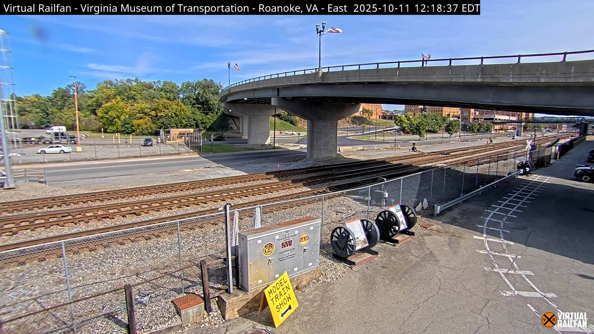
This live stream shows Roanoke, a city in the Roanoke Valley of southwestern Virginia. It is a practical way to check conditions in the valley, which sits between the Blue Ridge and Allegheny mountains. The stream comes from a third-party source and is embedded here with a link back to its owner.
Roanoke grew up around railroads and manufacturing and today is the largest city in the western part of the state. It sits at roughly 300 metres above sea level, surrounded by ridges that give the valley its character. The Blue Ridge Parkway passes close by, and the Roanoke River runs through town. The city is known for its historic downtown, its market and its role as a gateway to the mountains of the region.
The view is most useful for checking how the valley looks at different times of day. Morning often brings low cloud or mist in the hollows, while afternoon light shows the ridgelines more clearly. Seasonal change is strong here: autumn colours on the surrounding slopes are a common reason people look in, and winter can bring snow or ice that lingers longer on shaded areas. Because the picture is a live stream, conditions can shift quickly during storms.
Roanoke has a humid subtropical to humid continental climate, with warm summers and mild to cold winters. Spring and autumn are generally the most comfortable seasons for outdoor visits. Nearby cameras on this site include Shawsville on Bent Mountain, about 21 km away, and Radford at the university, roughly 56 km off. These can help you compare conditions across the wider region.
Source: Virtual Railfan
Virginia, United States — 21 km

Virginia, United States — 56 km

Virginia, United States — 81 km
North Carolina, United States — 104 km

West Virginia, United States — 109 km
West Virginia, United States — 110 km

West Virginia, United States — 110 km

Virginia, United States — 113 km

Virginia, United States — 113 km

Virginia, United States — 114 km
The current conditions and a 3-day forecast for Roanoke are shown in the live weather block on this page, updated automatically.
The local time for Roanoke is displayed on this page and follows Eastern time, including daylight saving changes.
The camera is in Roanoke, Virginia, at about 37.27 degrees north and 79.94 degrees west, and the map on this page shows its position.
Early morning and late afternoon usually show the most detail in the valley light, and autumn is popular for the colours on the surrounding hills.
Partner links: we may earn a commission at no extra cost to you.