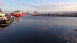
Los Angeles - Port of LA - Wilmington
California, United States — 1.4 km
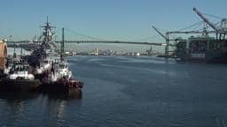
Los Angeles - Port of LA - San Pedro
🇺🇸 California · United States — Altitude 4 m
This camera looks out over the Port of Los Angeles, one of the busiest container harbors in the United States. It is a practical window for anyone curious about harbor activity, cargo ships and the working waterfront at San Pedro. The page also shows local time and current weather so you can judge conditions before you watch.
San Pedro is the harbor district of the city of Los Angeles, on the Pacific coast south of downtown. The port complex handles a very large share of the country's container traffic and has grown into a major industrial waterfront with cargo terminals, cranes and breakwaters. The area keeps a strong maritime character, with fishing history and a working-class harbor identity that differs from the beaches further north. The shoreline is flat and open, and the sea air is usually mild.
Harbor cameras are most interesting when vessels are moving, so daylight hours often bring the most activity, including container ships entering or leaving and tugs assisting them. Clear afternoons offer the best visibility across the water, while overcast or hazy days can soften the view. Ship movements are irregular and depend on the schedule of the terminals, so a quiet period is normal. Expect the scene to change more with traffic than with the seasons.
Los Angeles has a mild Mediterranean climate, with warm, dry summers and cool, mostly sunny winters, and the coast is typically a few degrees cooler than inland areas. Visitors who want to see the harbor in person can explore San Pedro's waterfront and the nearby Wilmington area. Other live views in the region include the Port of LA Wilmington camera, about one kilometer away, and cameras in Long Beach roughly eight kilometers to the southeast.
Source: earthcam.com
California, United States — 1.4 km
California, United States — 8 km
California, United States — 8 km
Mississippi, United States — 15 km
California, United States — 15 km
California, United States — 18 km
California, United States — 18 km

California, United States — 18 km
California, United States — 18 km

California, United States — 22 km
The current conditions and a three-day forecast for the Port of Los Angeles area are shown in the live weather block on this page. They update with the page, so check there for the latest values.
The local time for San Pedro is displayed on this page, based on the Pacific time zone used in Los Angeles. The clock shows the current time for the harbor area.
The camera is in San Pedro, the harbor district of Los Angeles, on the Pacific coast. The map on this page marks its position over the port.
Daylight hours usually give the clearest view and the most ship movement. Clear afternoons are often the best, though vessel traffic depends on terminal schedules.
Partner links: we may earn a commission at no extra cost to you.