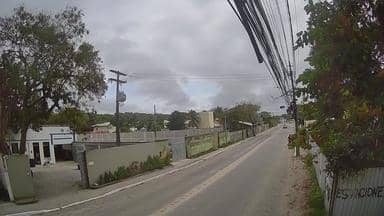
Porto Seguro - Estrada da Balsa - Arraial d´Ajuda - Noroeste
Bahia, Brazil — 0.8 km
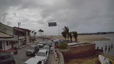
Porto Seguro - Balsa Porto Seguro - Arraial d´Ajuda - Leste
🇧🇷 Bahia · Brazil
This live camera follows the ferry crossing at Porto Seguro, where the river meets the Atlantic and boats link the historic town with Arraial d'Ajuda. It is a practical window onto the coastal traffic of southern Bahia. The page also shows local time and the forecast for the area.
Porto Seguro sits on the coast of Bahia in northeastern Brazil and is widely known as the place where Portuguese navigators first landed in 1500. The town is built around a river mouth, and the ferry is one of the everyday ways residents and visitors move between its banks. Beyond the old centre, the coast is lined with palm-fringed beaches and reef-protected bays that draw travellers throughout the year.
The camera is focused on the ferry crossing, so most of the activity is boats loading, departing and docking. Traffic tends to be busiest in the morning and late afternoon, when commuters and day-trippers cross. Weather changes the view quickly, with sunlight on the water in clear conditions and haze or rain showers during the wetter months. Check the live player to see current conditions on the river.
The region has a warm tropical climate with high humidity, and temperatures stay fairly steady across the year. The drier months from roughly August to January are generally considered the most comfortable for beach visits. Porto Seguro has its own airport, and the nearby cameras on this site show the road to Arraial d'Ajuda and the Trancoso airport area for more context.
Source: climaaovivo.com.br
Bahia, Brazil — 0.8 km

Bahia, Brazil — 7.8 km

Bahia, Brazil — 10 km
Bahia, Brazil — 388 km
Bahia, Brazil — 388 km
Bahia, Brazil — 399 km

Bahia, Brazil — 424 km
Bahia, Brazil — 438 km
Espírito Santo, Brazil — 448 km

Bahia, Brazil — 468 km
The current conditions and a three-day forecast for Porto Seguro are shown in the weather block on this page. They update with the page, so you can check before heading to the ferry.
The local time for Porto Seguro is displayed on this page, based on the Bahia time zone. It is useful for planning ferry crossings and calls to local businesses.
The camera looks at the ferry crossing between Porto Seguro and Arraial d'Ajuda on the eastern side of the river. The map on this page marks its position on the coast of Bahia.
Morning and late afternoon usually bring the most ferry movements as people commute and visitors travel. Clear daytime hours show the water and boats most clearly, though the view depends on the weather.
Partner links: we may earn a commission at no extra cost to you.